San Juan Islands Cruising Guide: Summer Routes, Anchorages, and Tides
San Juan Islands Cruising Guide: Summer Routes, Anchorages, and Tides
Summer in the San Juan Islands runs roughly mid-June through Labor Day, with sunsets after 9 PM, daytime highs of 67–71°F, and the rain-shadow weather that makes NOAA Chart 18421 the busiest paper in the Salish Sea.
A contrarian opener: the worst time to cruise the San Juan Islands is the week most people pick. July 4 weekend in Roche Harbor is a parking lot. Sucia's Echo Bay fills by noon Friday. The actual sweet spot, in any honest san juan islands cruising guide, is the second week of June or the first week of September. Same rain shadow. Half the boats.
This is a san juan islands boating guide for the summer window, written for skippers who'd rather plan around currents than hashtags.
The Place
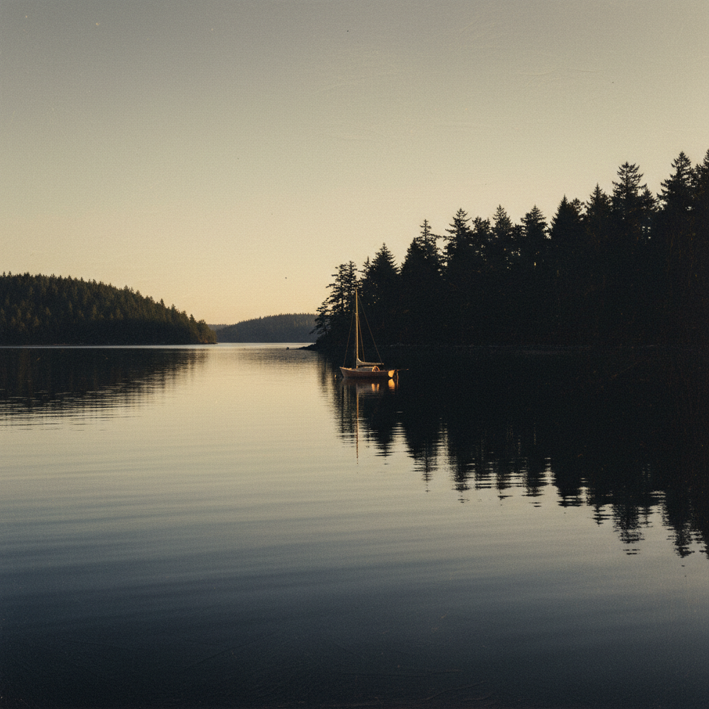
The San Juan archipelago sits in the northwest corner of Washington State, tucked between Vancouver Island and the mainland, in the rain shadow of the Olympics. Roughly 48°32′N, 123°00′W. Four islands carry ferry service: San Juan, Orcas, Lopez, Shaw. Dozens more do not.
From Anacortes to Friday Harbor: about 20 nautical miles. From Seattle's Shilshole, closer to 75. From Bellingham via Hale Passage and Thatcher Pass, around 30. Cruising from Seattle to the San Juan Islands is a two-day run for most displacement boats, an overnight push for faster hulls.
The chart you want is NOAA 18421. Print it. The phone dies.
The Window
Summer here is short and reliable. Highs sit in the upper 60s to low 70s. Water temperature in the shallow bays climbs into the mid-60s by August, which is swimmable if you grew up here and bracing if you didn't.
Prevailing wind in July and August is northwesterly, building through the afternoon as the Juan de Fuca outflow funnels east. Mornings are glass. Afternoons chop up by 1400. Plan your exposed crossings, Rosario Strait, Boundary Pass, San Juan Channel, before lunch.
Fog is a June and September story more than a July one. When it sits, it sits thick on the water and burns off by 1100. Smoke season, if it arrives, lands in mid-August.
Tidal current planning is the protagonist. Cattle Pass, Spieden Channel, and the gates around Stuart Island can run 4 to 6 knots. A current atlas and a slack-water plan are not optional. Marine weather patterns in the Pacific Northwest reward skippers who read the sky and the tide tables together.
The Route: A Five-Day San Juan Islands Cruise Guide
A defensible five-day loop from Anacortes. Distances are nautical miles. Times assume a 7-knot cruise.
| Leg | From → To | Distance | Run Time | Note |
|---|---|---|---|---|
| 1 | Anacortes → Friday Harbor | 20 nm | ~2.5 hrs | Thatcher Pass on a fair tide |
| 2 | Friday Harbor → Stuart Island (Reid Harbor) | 12 nm | ~1.5 hrs | Time Spieden Channel near slack |
| 3 | Stuart Island → Sucia Island (Echo Bay) | 14 nm | ~2 hrs | Cross Boundary Pass before afternoon chop |
| 4 | Sucia Island → Deer Harbor, Orcas | 11 nm | ~1.5 hrs | Quiet south approach via President Channel |
| 5 | Deer Harbor → Anacortes | 22 nm | ~3 hrs | Through Wasp Passage, watch ferry traffic |
Friday Harbor is the regional hub and the primary U.S. port of entry for vessels arriving from Canada. Roche Harbor is no longer a Customs Port of Entry, a detail the Waggoner Cruising Guide flags in every recent edition. Crossing the border now runs through the CBP ROAM app for most pleasure boaters.
What to Skip and What to Do
Do:
- Take a Washington State Parks mooring buoy at Sucia, Stuart, Jones, or Matia. Self-pay, first-come.
- Anchor in Blind Bay on Shaw Island for a quiet night with good holding in 30 feet.
- Run the dinghy into Prevost Harbor for the cross-island walk to Turn Point Lighthouse.
- Provision in Friday Harbor before heading north. The selection thins fast.
Skip:
- Roche Harbor on July 4 unless the fireworks are the point.
- The west side of San Juan Island in a building northwesterly. It's a lee shore with no graceful exit.
- Any plan that requires transiting Cattle Pass against a 5-knot ebb. Wait it out.
A note on orcas. Washington State law requires vessels to stay 1,000 yards from Southern Resident Killer Whales. This is enforced. Shut down, drift, and let them pass. The Salish Sea navigation rules around marine mammals are stricter here than almost anywhere on the coast.
Provisioning and Practical
Fuel docks worth knowing: Friday Harbor (Port of Friday Harbor), Roche Harbor Marina, Deer Harbor Marina, West Sound Marina on Orcas, Lopez Islander on Lopez. Prices track Anacortes plus a premium that grows with distance from the ferry terminal.
Groceries: Friday Harbor (King's Marine and the Saturday market), Eastsound on Orcas (full-size grocery, a short cab from Deer Harbor), Lopez Village (small but credible). Shaw has a single general store at the ferry landing, and that is the entire commercial footprint of the island.
Cell coverage is solid around Friday Harbor, Roche, and Eastsound. It drops to nothing in Reid Harbor, most of Sucia, and the north side of Stuart. VHF Channel 16 is the bridge, then 66A for marina hails. Channel 9 is hailing in some harbors.
Ice and propane: Friday Harbor and Roche Harbor reliably. Elsewhere, plan ahead.
For deep reference, the Waggoner Cruising Guide and the Dreamspeaker Cruising Guide series are the two print volumes most experienced PNW skippers keep aboard. They disagree on enough small things to be useful together.
FAQ
What is the best time of year for a San Juan Islands cruise guide itinerary? Mid-June to mid-September is the cruising season. The shoulder weeks, second week of June and first week of September, offer the same rain-shadow weather, water temperatures in the low 60s, and roughly half the anchorage traffic of peak July and August.
Is Roche Harbor still a US Customs Port of Entry? No. Roche Harbor is no longer a Customs Point of Entry. Vessels arriving from Canada clear at Friday Harbor, Bellingham, Anacortes, or Point Roberts, typically via the CBP ROAM app. The Waggoner Cruising Guide notes this change in current editions.
San Juan Islands vs Gulf Islands for cruising, which wins? Different trips. The San Juans are tighter, with shorter hops, more state park moorage, and U.S. provisioning. The Gulf Islands sit north across Boundary Pass in British Columbia, with longer reaches, fewer crowds in many anchorages, and a customs clearance on each end. Most PNW cruisers do both in a single summer.
What are the best anchorages in the San Juan Islands? Echo Bay and Fossil Bay at Sucia Island, Reid Harbor at Stuart Island, Blind Bay at Shaw, Prevost Harbor, and Westcott Bay on San Juan Island all hold well in summer conditions. Most have Washington State Parks mooring buoys as an alternative to anchoring.
Schedule a Tour →
Sources
- [Summer in the San Juan Islands, Visit San Juans](https://www.visitsanjuans.com/summer-
Related Articles
Stuart Island Anchorage: Prevost & Reid Harbors
Stuart Island, at the northwest edge of the San Juan Islands, offers two of the most protected anchorages in the Salish Sea. Prevost Harbor and Reid Harbor provide sand-and-mud holding in 25 to 30 feet and all-weather shelter from every quadrant.
Yacht Video Production in Seattle: What Cinematic Listing Footage Should Cover on Puget Sound
Professional yacht video production in Seattle layers four distinct camera perspectives — aerial drone, on-water gimbal, walkthrough Steadicam, and lifestyle handheld — into a single cinematic edit that sells a vessel before a buyer ever steps aboard.
Reading PNW Boating Weather Windows for Spring Passage Planning
A PNW boating weather window is a stretch of 48 to 96 hours when wind, swell, and pressure trends align for a coastal passage, and in spring, the Pacific Northwest typically delivers them only after the Aleutian Low retreats and the North Pacific High builds, usually from mid-April through June.